Solar Eclipse Prime Page
Total Solar Eclipse of 1683 Jul 24
Fred Espenak
Introduction
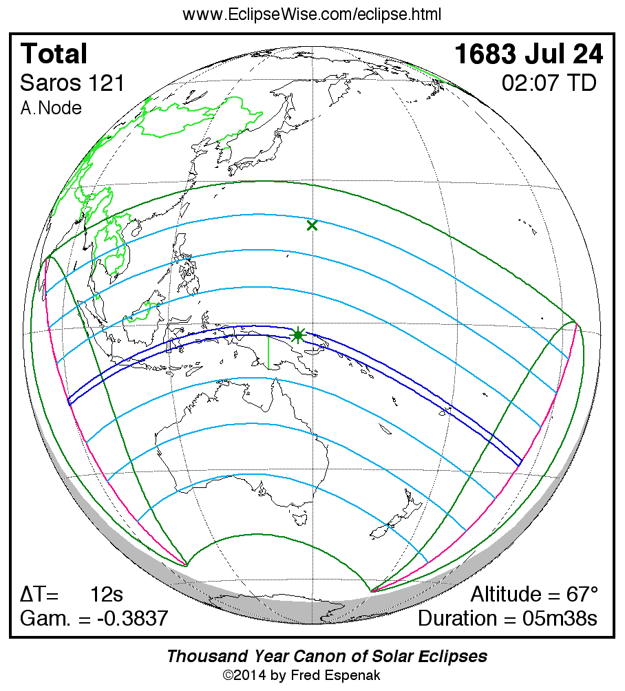
The Total Solar Eclipse of 1683 Jul 24 is visible from the geographic regions shown on the map to the right. Click on the map to enlarge it. For an explanation of the features appearing in the map, see Key to Solar Eclipse Maps.
The instant of greatest eclipse takes place on 1683 Jul 24 at 02:06:59 TD (02:06:47 UT1). This is 1.8 days before the Moon reaches perigee. During the eclipse, the Sun is in the constellation Cancer. The synodic month in which the eclipse takes place has a Brown Lunation Number of -2961.
The eclipse belongs to Saros 121 and is number 42 of 71 eclipses in the series. All eclipses in this series occur at the Moon’s ascending node. The Moon moves southward with respect to the node with each succeeding eclipse in the series and gamma decreases.
The solar eclipse of 1683 Jul 24 is a relatively long total eclipse with a duration at greatest eclipse of 05m38s. It has an eclipse magnitude of 1.0569.
The total solar eclipse of 1683 Jul 24 is followed two weeks later by a partial lunar eclipse on 1683 Aug 07.
These eclipses all take place during a single eclipse season.
The eclipse predictions are given in both Terrestrial Dynamical Time (TD) and Universal Time (UT1). The parameter ΔT is used to convert between these two times (i.e., UT1 = TD - ΔT). ΔT has a value of 11.7 seconds for this eclipse.
The following links provide maps and data for the eclipse.
- Orthographic Map: Total Solar Eclipse of 1683 Jul 24 - global map of eclipse visibility
- Google Map: Total Solar Eclipse of 1683 Jul 24 - interactive map of the eclipse path
- Path Table: Total Solar Eclipse of 1683 Jul 24 - coordinates of the central line and path limits
- Circumstances Table: Total Solar Eclipse of 1683 Jul 24 - eclipse times for hundreds of cities
- Saros 121 Table - data for all eclipses in the Saros series
The tables below contain detailed predictions and additional information on the Total Solar Eclipse of 1683 Jul 24 .

